RSE National Center of Geodesy and Spatial Information presents an innovative Kazakh IT development - a spatial data web portal
Our portal is an efficient management and development of the National Cartographic and Geodesic Foundation's electronic archive infrastructure, a centralized model for the provision of electronic services and services to government agencies, legal entities and individuals.
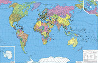
This is the first electronic map of historical survey background of Kazakhstan territory which has an easy-to-use interface for finding information for the scheduled work areas. Here you will find analogue topographic maps, compilation and fair copies, original updates of maps and settlement plans from the collection's archive.
As well as pts catalogues, compiled catalogues and supplements, technical reports and facility catalogues.
In addition to the information listed above, portal contains data on digital topographic maps and plans, orthophotomaps with information on the condition of the area and the year of the survey. The portal will be useful in the hands of any entrepreneur, you will also find the regulations and the user manual here. The web portal is user-friendly and easy to use; system is always at your fingertips: EDS, internet and any mobile device are required for logging in. The portal is a systematic collection of spatial data on the entire territory of the Republic, does not contain information that constitutes a State secret, and has been created in the form of digital topographic maps at various scales.
The generation of requests for materials contained in the Fund is only available to registered users. The provision of information on geodetic and map coverage of the area to interested parties is performed in accordance with the rules approved by Order No. 164 of the Minister of National Economy. To obtain the information, it is necessary to submit an application, by filling in an electronic application form in the web portal's material and data retrieval system - geoportal.nkgf.kz
We support entrepreneurs, pursue your business ideas with courage, because the web portal is a great place to plan your work. Ensuring the public awareness is our main task!
Now the entities of geodesic activities will have the tools to increase output, reduce reject rates, cut costs, eliminate duplication, and reduce labour costs by up to 60%.
- You will get an opportunity to analyze the environment and regulate your processes!
- You will know the alternate solutions for standard situations and incidents!
- You will see the fund data accessibility!
You can use feedback to ask us any questions and make suggestions to improve our service. Register and join the portal management process, all data is open to you! We work with care for you!
Modernization of the state geodetic support system of the Republic of Kazakhstan provides for the development of state geodetic, leveling, gravimetric networks taking into account modern satellite and information technologies.