“Batysgeodesia” branch
History of education:
On April 19, 1979, the topographic and geodetic Expedition No. 108 was established in Aktobe by Order of the Main Directorate of Geodesy and Cartography under the Council of Ministers of the USSR No. 162P. In 1992, Expedition No. 108 was renamed into the Cartographic and Geodetic Enterprise "Aktobe Geodesy" of the Main Department of Geodesy and Cartography under the Cabinet of Ministers of the Republic of Kazakhstan. In 1994, a modern administrative and household building was put into operation at the address: Aktobe, ul. 101 Rifle Brigade, 2. On May 25, 2000, in accordance with the Decree of the Government of the Republic of Kazakhstan No. 794, the KGP "Aktyubgeodeziya" was renamed the Republican State-owned enterprise "Zapgeodeziya" of the Agency of the Republic of Kazakhstan for Land Management.
According to the Resolution of the Republic of Kazakhstan No. 668 dated 30.06.2010, the reorganization of the RSE "Zapgeodeziya" took place by merging the Agency of the Republic of Kazakhstan for Land Management into the RSE "Kazgeodeziya" and the creation of a branch of "Batysgodeziya". By the Decree of the Government of the Republic of Kazakhstan No. 559 dated 08.09.2020, the RSE "Kazgeodeziya" branch of the "Batysgeodeziya" Committee of Geodesy and Cartography of the Ministry of Digital Development, Innovation and Aerospace Industry of the Republic of Kazakhstan was reorganized by merging and transforming into a republican state enterprise on the right of economic management "National Center of Geodesy and Spatial Information" of the Committee of Geodesy and Cartography of the Ministry of Digital Development, Innovation and the aerospace industry of the Republic of Kazakhstan.
The Batysgeodeziya branch performs the following types of work:
The "Batysgeodeziya" branch of the RSE at the "National Center for Geodesy and Spatial Information" offers a range of services for activities based on the principles of using advanced high-precision technologies, the complexity of performing topographic and geodetic, cartographic, land management and aerial survey work in any volume and in the shortest possible time.
The "Batysgeodesia" branch was established in order to meet the needs of the national economy, science, culture, education and certain branches of the republic with topographic, geodetic and cartographic products, to ensure the defense and security of the country.
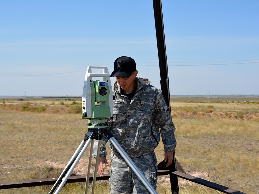
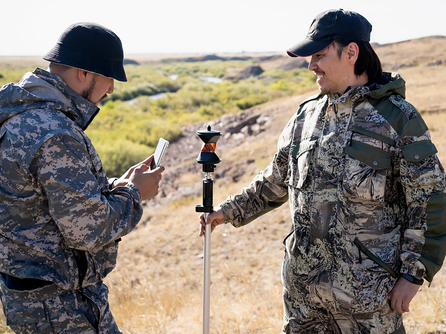
Topographic and geodetic production in the organization is based on the application of the most advanced methods and developments in the field of modern geodetic equipment. We use these and other devices to carry out a full range of work at various facilities. Our highly qualified specialists are equipped with all the necessary equipment, which allows us to ensure high accuracy and quality of the work performed, as well as our surveyors are able to solve the tasks assigned to them, keeping a balance between deadlines, cost and quality of materials at the output.
The "Batysgeodesia" branch as part of the RSE "National Center of Geodesy and Spatial Information" has started large-scale work on the creation of a new coordinate system and heights of the Republic of Kazakhstan. For this purpose, a satellite geodetic network is being created, within the framework of which permanent reference stations receiving signals from global satellite systems will be installed on the territory of the republic.
The branch has its own building, auto garage, production and technical equipment, air, water and motor vehicles, the necessary equipment and highly qualified specialists to perform the services offered:
- Large-scale topographic surveys of cities, district centers, settlements, factories, industrial facilities, oil and gas fields of scale (1:200, 1:500, 1:1 000, 1: 2000, 1: 5 000, 1:10 000);
- Engineering and geodetic surveys for the design of railways, highways, power lines, power lines, gas, oil, water pipelines and civil and industrial construction facilities;
- Creation of digital maps and plans;
- High-precision leveling of classes I and IV;
- Performing special geodetic works;
- Construction and development of filming networks;
- Center work and removal of wells in kind at oil and gas fields;
- Aerial photography and processing of materials to obtain an orthophotoplane;
- 3D terrain models on aircraft;
- Bathymetric survey:
- conducting high-precision deep-sea bottom survey for a complete representation of the state of the reservoir;
- construction of longitudinal and transverse profiles of the bottom of the reservoir;
- determination of water volume;
- depth detection;
- monitoring of the coastline. - Hydrographic works and surveys, using modern and high-quality equipment.
- Cartographic works: maps of different scales, themes and purposes.
- Land management works:
- determination of the coordinates of boundary markers;
- removal of known points by coordinates;
- topographic survey for acts of selection of land plots.
To perform the work, the branch has modern technical latest geodetic equipment and tools:
- Supercam S350F and DelAIR UX11 unmanned aerial vehicles;
- ADS-40 AG "Leica geosystems" aerial survey complex;
- aerial survey complex Phase ONE Aerial System 150MP;
- innovative laser scanner;
- multi-frequency GNSS receivers;
- electronic robotic total stations;
- dual-frequency GPS receivers;
- electronic total stations;
- digital levelers produced by "South", "Leica", "Topcon";
- tracers;
- GPS navigators;
- AN-2 aircraft and Cessna 172N Skyhawk aircraft with installation cameras.
The branch has the following licenses and certificates:
- License to carry out prospecting activities;
- ISO 9001 Certificate of Quality Management System;
- ISO 14001 Certificate of Environmental Management System;
- OHSAS 18001 Certificate of Occupational Safety and Health Management System.
- Certificates for instruments and instruments.
The branch has experience in performing work on orders of:
- JSC "Uzenmunaygas"
- JSC "CNPC - Aktobemunaygas"
- Zhanazholsky GPP
- "Atyrau Refinery" JSC
- DAO "Caspian Oil TME"
- Shymkent Oil Refinery of JSC Petroleum Kazakhstan Oil Products
- AF "Alties Petroleum International B.V."
- LLP "Karatube International Oil Companies"
- JSC "KKM Operating Company"
- JSC TNK "Kazchrome"
- "Zhobalyk sheshim" LLP
- "Geoplasma" LLP
- "Tethys Aral Gas" LLP
- "Kul - Bas" LLP
- "Geo Center Astana" LLP
- Government agencies and institutions
- Private individuals
We really appreciate the trust of our customers and make every effort to perform the necessary services efficiently and on time.
Our contact numbers:
Director: Kanaliev Baurzhan Kairatovich, +7 701 333 2299
E-mail: This email address is being protected from spambots. You need JavaScript enabled to view it.
Deputy. Director – Chief Engineer: Zhekeev Yesen Kuanovich, +7 775 703 1130
E-mail: This email address is being protected from spambots. You need JavaScript enabled to view it.


Modernization of the state geodetic support system of the Republic of Kazakhstan provides for the development of state geodetic, leveling, gravimetric networks taking into account modern satellite and information technologies.