Bathymetric survey is the process of data gathering on the depths of water bodies in the study area
Performed using special technical facilities, such as single beam and wideband echo sounders based on acoustic, pulse-based distance measurement method with the necessary software, and equipped with floating equipment. The results of bathymetric survey constitute a geo-referenced data set containing information on the spatial distribution of depths, which can be used to analyze bottom topography, determine bottom sediments, produce bathymetrical maps, or handle of applied problems.
Cartographic support for water bodies is one of the key measures for regulation of public interests in the rational use and protection of water bodies, as well as the protection of territories from emergency situations involving floods, mudflows and other water hazards.
Сollection and analysis of materials is the package of works required to establish a detailed design
Consists of the following activities:
- Request for materials (catalogues and maps from previous years);
- State of site exploration (location, physico-geographical conditions);
- Selection of coordinate system (conditional coordinate system, local coordinate system, СК-42, WGS - 84);
- Selection of survey scale.
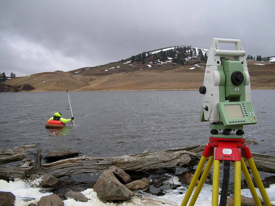
Field works are a set of activities carried out directly on a body of water (sea, lake, river, reservoir)
- Creation of control survey (pointing, coordinates, levelling);
- Survey of water body using echo sounder;
- Tacheometric survey of tacheometric survey (for detailed lay-out, study of waterlogged areas);
- Determining the water's edge (defining the line of intersection of the water surface of any basin (watercourse of rivers or reservoir) with the land surface);
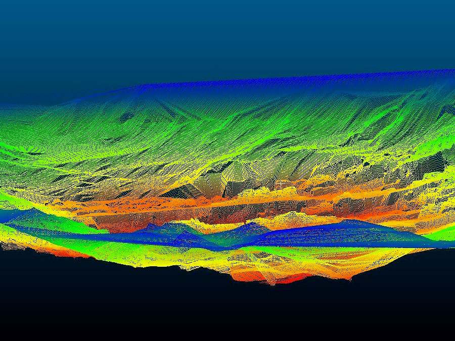
Office study is a set of works for processing of field investigations
- Processing on specialised bathymetric survey software;
- Creating three-dimensional models of the submarine relief;
- Formation of bathymetrical maps;
- Processing a tachymetric survey of maritime belt;
- Overlaying a tachymetric survey on a bathymetric survey for detailed analysis;
- Preparation of technical report on the work performed.
Technical fit-out
- Echo sounder with dedicated software - 4 units;
- Swamp buggy - 2 units;
- Water scooter - 4 units;
- Inflatable boats with motor - 4 units.


Modernization of the state geodetic support system of the Republic of Kazakhstan provides for the development of state geodetic, leveling, gravimetric networks taking into account modern satellite and information technologies.