“Soltustikgeodesia” branch
Address: Kokshetau, 131 Malik Gabdullin Str.
Phone: +7 / 7162/ 32 9 189
Email: This email address is being protected from spambots. You need JavaScript enabled to view it.
History of establishment
Expedition No.162 of enterprise No.9 by order of GUGK at the Council of Ministers of the USSRNo.595 dated 30/12/1980, was renamed since 01/01/1981 into the Integrated Complex Expedition No.162 (OKE No.162) of Ural Aerogeodetic Production Association "Uralaerogeodesy”.
By the Decree of theRK Government No. 26 dated 09/03/1992was renamed to Kokshetau cartographic and geodetic enterprise “Kokshetaugeodesia” of the Kazakh Aerogeodesic Enterprise "Kazgeodesia".
By the Decree of theRK Government No. 794 dated 31/05/2000was renamed as Republican state budget-supported enterprise "Sevgeodesiya" of the Land Management Agency of the Republic of Kazakhstan.
Order No. 03-03-05/п dated 19/08/2010 was renamed as a branch of the Republican state budget-supported enterprise “Kazgeodesia” “Soltustikgeodesia” of the Land Management Agency of the Republic of Kazakhstan.
By the Decree of theRK Government No. 109 dated 08/02/2013was renamed as a branch of the Republican state budget-supported enterprise “Kazgeodesia” “Soltustikgeodesia” of the Bureau of Land Management of the Ministry of Regional Development of the Republic of Kazakhstan.
By the Decree of theRK Government No. 933 dated 14/08/2014was renamed as a branch of the Republican state budget-supported enterprise “Kazgeodesia” “Soltustikgeodesia” of the Committee for Construction, Housing and Public Utilities and Land Management of the Ministry of National Economy of the Republic of Kazakhstan.
By the Decree of theRK Government No. 295 dated 18/05/2016was renamed as a branch of the Republican state budget-supported enterprise “Kazgeodesia” “Soltustikgeodesia” of the Bureau of Land Management of the Ministry of Agriculture of the Republic of Kazakhstan.
By the Decree of theRK Government No. 501 dated July 12, 2019was renamed as a branch of the Republican state budget-supported enterprise “Kazgeodesia” “Soltustikgeodesia” of the Committee on Geodesy and Cartography of the Ministry of Digital Development, Innovation and Aerospace Industry of the Republic of Kazakhstan.
The organization is currently a branch of the “Saltustikgeodesia” of the Republican State Enterprise on the Right of Economic Use “National Center of Geodesy and Spatial Information” of the Committee on Geodesy and Cartography of the Ministry of Digital Development, Innovation and Aerospace Industry of the Republic of Kazakhstan. Decree of theRK Government No. 559 dated September 08, 2020.
Types of works performed by government order:
- Survey of triangulation points,
- Survey and restoration of benchmarks, determination of coordinates and elevations of points
- Decoding of built-up and undeveloped areas M 1:2 000.
- Class I, II levelling
- Field work for updating maps of M 1:25,000
- Office study for the creation and updating of digital topographic maps M 1:25,000, 1:50,000, 1:100,000
- Creation of digital topographic maps M 1:25 000 in the state language
- Creation of digital topographic maps M 1:50 000 in Russian
- Creating city plans on a scale of 1:2,000
Types of work performed under contracts with customers
- All types of topographic, geodetic, cartographic works and land-use planning
- Topographic surveys on scales from 1:200 to 1:10,000
- Engineering and geodetic survey of railroad and highways
- Constructing and laying geodetic centres;
- Creation of planning and altimetric survey networks;
- Topographic works for design and construction (surveys on scales from 1:10,000 to 1:200, as well as surveys of underground utilities and structures, tracing and surveying of surface structures and its elements);
- Survey operations associated with staking and fixing with reference to geotechnical excavations, geophysical and other survey points;
- Geodetic survey for land cadaster
- Creating and updating maps at scales of 1:500, 1:1 000, 1:2 000,1:5 000, 1:10 000, 1:25 000, 1:50 000, 1:100 000.
Land surveying
- Services for registration of land title (for buildings, constructions)
- Preparation of land use designs
- Ranging afield.
- Land cadastral works
Engineering-geological and engineering and hydrogeological survey, including:
- Geophysical survey,
- Reconnaissance survey;
- Field studies of soils, groundwater study;
- Observation of deformations of buildings and structures
Technical fit-out
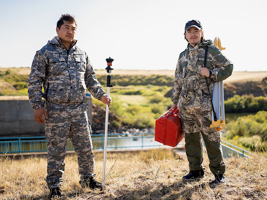
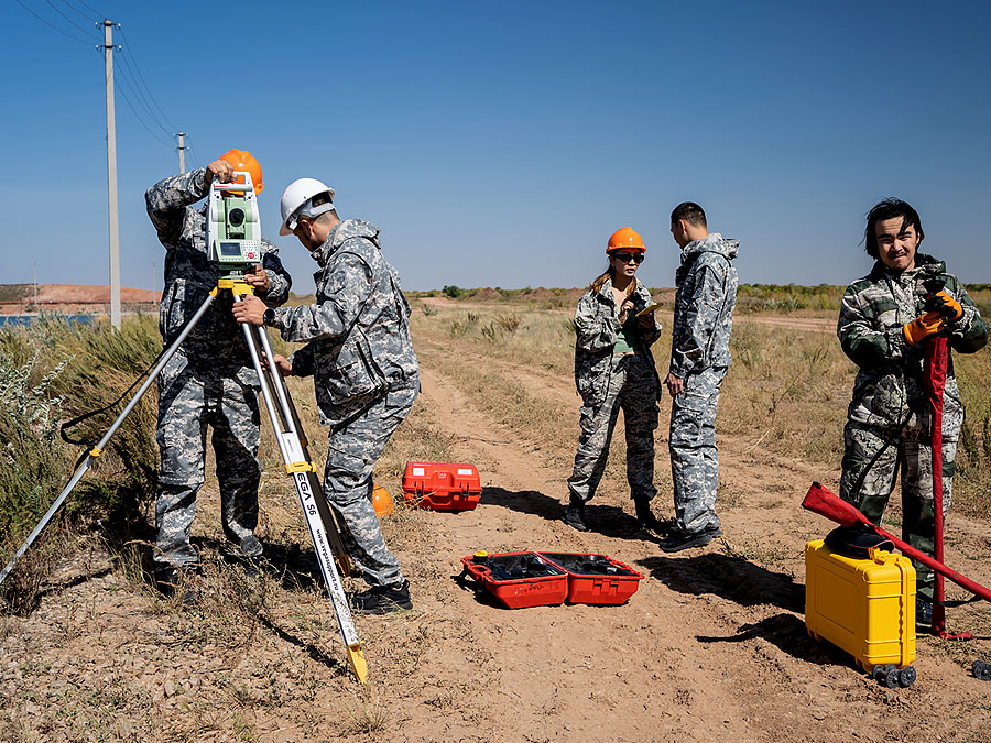
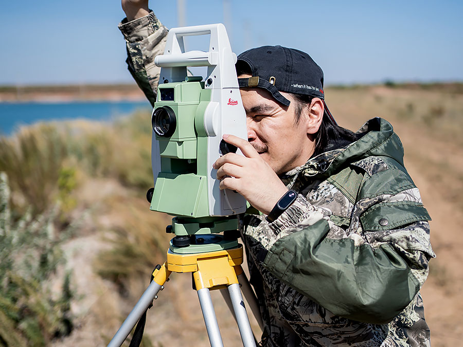
Our branch has the following technical equipment for performance of works:
- Land surveying equipment: GPS receivers, electronic total stations, digital and optical levels from AG Leicageosystems, «Leica». «CHC NAV», «Trimble», «TOPCON», light meters, trace detectors, GPS navigators, theodolites
- Computer hardware: personal computers, laptops, large format scanners and plotters
- Graphic stations for digital photogrammetry from AG Leicageosystems
- Software: ArcGIS 9.1, Microstation, MapInfo Professional, AutoCad
- Special purpose vehicles
The branch has experience in carrying out work on orders:
- KEGOC JSC
- KTZ NC JSC
- SKZ-Pyrite LLP Stepnogorsk
- Aralpetroleum LLP
- Pavlodarenergoproekt LLP
- Nur-Sultan International Airport
- State bodies and agencies
- Individual

Modernization of the state geodetic support system of the Republic of Kazakhstan provides for the development of state geodetic, leveling, gravimetric networks taking into account modern satellite and information technologies.