Information about the branch «Shygysgeodesia»
Address: Abai Region, Semey city, 32 Gabdullа Tukai Street
Phone: +7 /7222/ 521 061
Email: This email address is being protected from spambots. You need JavaScript enabled to view it.
History of establishment
The history of the company starts from thetopographic and geodetic surveying unitno. 33, set up in 1957. Based on Order No.41-11 of 20.11.1965 of the Main Directorate of Geological Survey under the USSR Council of Ministers, unit No.33 was renamed Expedition No.103. Based on the order of SDGC under the USSR Council of Ministers, Expedition No.103 of Enterprise No.6 was transformed into Kazakh Aerogeodetic Enterprise OKE No.103 (Order No.400 - P of 18.08.1986)
On the basis of Order No. 103 of the SDGC under the USSR Cabinet of Ministers, the Kazakh Aerogeodetic Enterprise OKE was transformed into the Semipalatinsk Map and Geodetic Enterprise (Order No. 24 dated 11.03.1992) Semipalatinsk Cartographic and Geodesy Enterprise has been renamed intoState-owned cartographic and geodesic enterprise «Semeygeodesia»(Order No. 16 – ОД dated 19.07.1996) on the basis of the Order of the SDGC under the USSR Cabinet of Ministers. Based on the Decree of the Government of the Republic of Kazakhstan, State Enterprise Cartography and Geodesy «Semeуgeodesia» was renamed the Republican State Enterprise «Vostokgeodesia»(Order N. 794 dated 25.05.2000)
According to the Decree of the Government of the Republic of Kazakhstan from 30.06.2010 № 668Republican state enterprise «Vostokgeodesia», was reorganized by merging into Republican state enterprise «Kazgeodesia» of the Agency of the Republic of Kazakhstan. In accordance with the Decree of the Government of the Republic of Kazakhstan from 08.02.2013 № 109 «Questions of the Ministry of Regional Development of the Republic of Kazakhstan» branch of State Enterprise «Kazgeodesia», «Shygysgeodesia» Agency of the Republic of Kazakhstan on land resources management renamed to branch of State Enterprise «Kazgeodesia» «Shygysgeodesia» Committee on Land Resources Management Ministry of Regional Development of the Republic of Kazakhstan - in accordance with Decree of the Government of the Republic of Kazakhstan No. 1011 of 24.09.2014 «Issues of the Ministry of National Economy of the Republic of Kazakhstan» branch of the State Enterprise «Kazgeodesia» «Shygysgeodesiya» of the Bureau of Land Management of the Ministry of Regional Development of the Republic of Kazakhstan was renamed the branch of the State Enterprise «Kazgeodesiya» «Shygysgeodesiya» of the Committee for Construction, Housing and Public Utilities and Land Resources Management of the Ministry of National Economy of the Republic of Kazakhstan.
In accordance with Government Decree No. 295 dated 18.05.2016«On Certain Issues of the Ministries of National Economy and Agriculture of the Republic of Kazakhstan»RNE «Kazgeodesia» of the Committee for construction, housing and utility sector and land management of the Ministry of National Economy of the Republic of Kazakhstan was renamed as the «Kazgeodesia» RNE of the Bureau of Land Management of the Ministry of Agriculture of the Republic of Kazakhstan.
In accordance with Government Decree No. 501 dated 12.07.2019 «On measures for implementation of Presidential Decree No. 24 dated 17.06.2019 «On measures to further improve the public administration system of the Republic of Kazakhstan». «Kazgeodesіа» RNE of the Bureau of Land Management of the Ministry of Agriculture of the Republic of Kazakhstan was renamed as «Kazgeodesia» RNE of the Committee for Geodesy and Cartography of the Ministry of Digital Development, Innovation and Aerospace Industry of the Republic of Kazakhstan.
In accordance with Governmental Decree No. 559 dated 08.09.2020 «On the reorganisation of some republican state enterprises under the jurisdiction of the Committee of Geodesy and Cartography of the Ministry of Digital Development, Innovation and Aerospace Industry of the Republic of Kazakhstan» «Kazgeodesia» RNE of the Committee for Geodesy and Cartography of the Ministry of Digital Development, Innovation and Aerospace Industry of the Republic of Kazakhstan was reorganised through a merger and transformation into a Republican State Enterprise on the Right of Economic Use«National Center of Geodesy and Spatial Information»of the Committee of Geodesy and Cartography of the Ministry of Digital Development, Innovation and Aerospace Industry of the Republic of Kazakhstan.
Types of work performed under the government order:
- Survey of triangulation points, survey and restoration of benchmarks, determination of coordinates and elevation of points;
- Interpretation of built-up and undeveloped areas M 1:2 000;
- Class I, II levelling;
- Field work for updating maps of M 1:25 000;
- Office study for the creation and updating of digital topographic maps M 1:25 000, 1:50 000, 1:100 000;
- Establishment of digital topographic maps M 1:25 000, 1:50 000, 1:100 000 in state language;
- Establishment of digital topographic maps M 1:50 000, 1:100 000 in russian language;
- Creation of city plans on a scale of 1:2 000.
Types of work performed under contracts with customers
All types of topographic, geodetic, cartographic and land surveying work
- topographic surveys on scales from 1:200 to 1:10 000;
- construction and laying of geodetic centres;
- creation of planned altimetric survey networks;
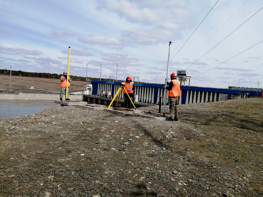
- high-precision geodetic measurements and observations of movements of the earth's surface and hydrotechnical structures of hydropower plants;
- topographic works for design and construction (surveys on scales from 1:10,000 to 1:200, as well as surveys of underground utilities and structures, tracing and surveying of surface linear structures and their elements);
- survey operations associated with the staking an fixing, with reference to geotechnical workings , geophysical and other survey points;
- survey operations for land cadaster;
- creating and updating maps at scales of 1:500, 1:1,000, 1:2,000,1:5,000, 1:10,000, 1:25,000, 1:50,000, 1:100,000;
- ranging afield;
- determination, approval and restoration of boundaries of the former Semipalatinsk nuclear test site and the boundaries of the test sites by geodetic method.
Technical fit-out
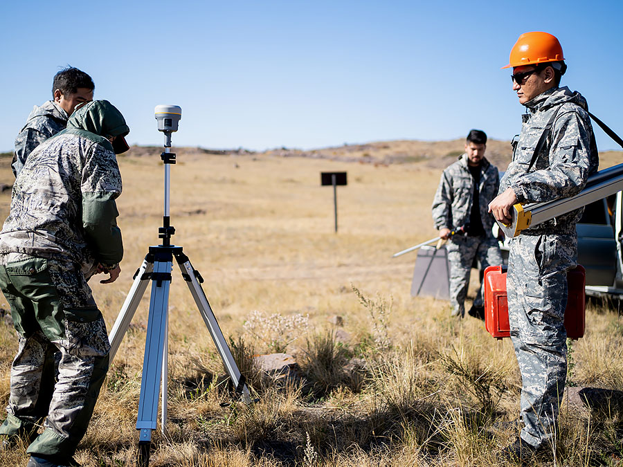
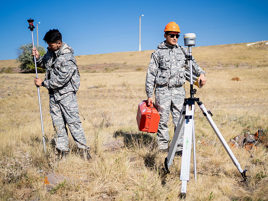
Our branch has the following technical equipment for performance of works:
- land surveying equipment: GPS receivers, GPS navigators, electronic total stations TC-407, digital and optical levels from AG «Leicageosystems», «TOPCON», line locators, Computer hardware: PCs, laptops, large format scanners and plotters;
- graphic stations for digital photogrammetry from AG «Leicageosystems»;
- software: Macrostation v8, Mapinfo Professional 8.0, Adobe Photoshop CS 2, Transform 2.0, Leica survey office/ Geo office, Printer Emulator;
- special purpose vehicles with off-road capability;
- LS 10 0.3 mm optical digital leveling;
- Trimble Dini 0.3 digital leveling;
- «NAV P5E» GNSS SNS receivers.
The branch has experience in performance of works by the orders:
- «National Nuclear Centre of the Republic of Kazakhstan» RSE;
- «Zemlyoustroitel» LLP;
- «Shulbinskaya HPP» LLP;
- «FML Kazakhstan» LLP;
- SMR «SEMY ORMANY» LLP
- Branch «Hydraulic structures» of the RSE «Kazakhstan su zholdary»;
- State bodies and agencies;
- Individuals.

Modernization of the state geodetic support system of the Republic of Kazakhstan provides for the development of state geodetic, leveling, gravimetric networks taking into account modern satellite and information technologies.