Aeroplane photography
Purpose – obtaining the spatial data
Technological infrastructure:
- Airplane АН-2
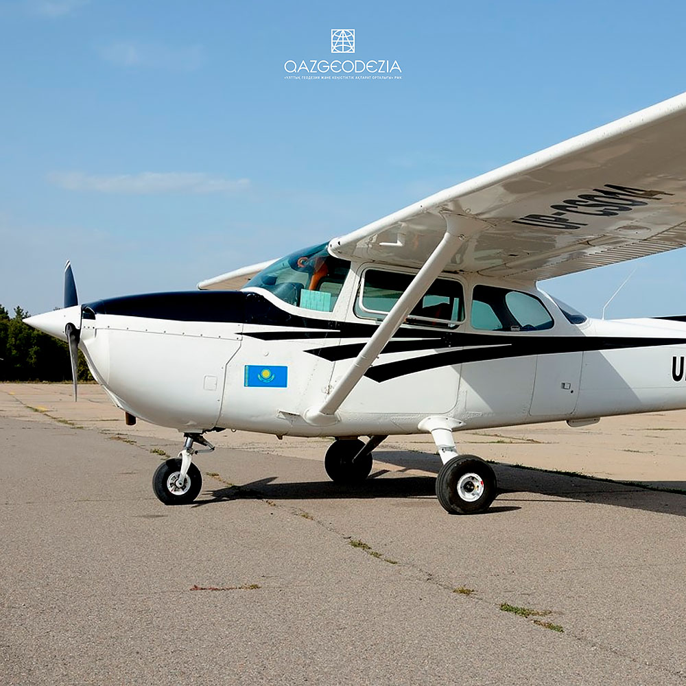
- Airplane Cessna 172N
- Aerophotographic system Phase One
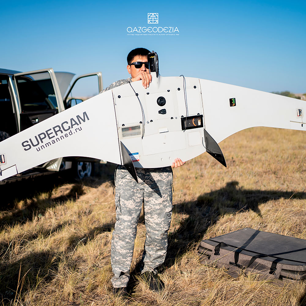
- Unmanned aerial vehicle Supercam S350F
- Unmanned aerial vehicle Delair UX-11
Action:
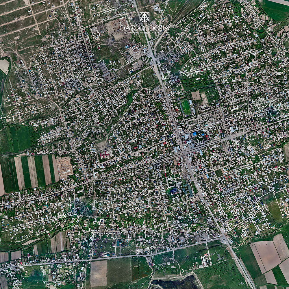
Aeroplane photography of linear and area facilities from man-carrying aircraft and unmanned aerial vehicles.
Result:
- Orthophotomap;
- Dense point cloud;
- Digital elevation model;
- 3D- terrain model;
- Digital topographical plan or map.
If you have any questions:
Telephone: +7 (7172) 248 624
Email: This email address is being protected from spambots. You need JavaScript enabled to view it.
Address: Astana city, 19 Kabanbay batyr Ave., Block А
Modernization of the state geodetic support system of the Republic of Kazakhstan provides for the development of state geodetic, leveling, gravimetric networks taking into account modern satellite and information technologies.